


Today, thanks to drones and RTK technology, it is possible to carry out fogrametric surveys with great precision.
Drone photogrammetry allows us to take many more reference points, reach places that are difficult to access, obtain new results such as point clouds, 3D models and all this in a much more economical way than classic topography.
The realization of aerial photogrammetry services using drones allows, in an easy and moderately affordable way, to obtain images that were previously impossible to imagine. It allows to generate with great precision 3D surveys applicable in numerous fields.
The acquisition of high-resolution images together with the high precision of the coordinates taken by our drones, allow us to carry out a survey or three-dimensional maps of dangerous, inaccessible or difficult to access areas, without endangering the operators.
In addition, large areas of land can be covered in a short time, controlled from a secure location and in a relatively cheaper way than the alternatives.
This technique is used to obtain maps and plans of large extensions of land, by means of the composition of many photographs located with GPS centimeter precision.
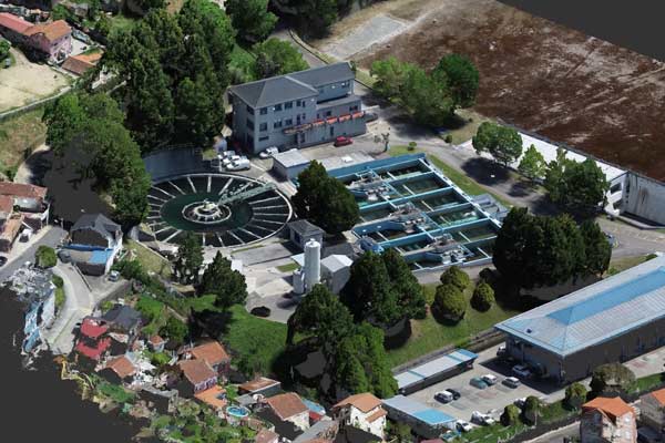
3D recreated image of a Wastewater Treatment Plant (WWTP) survey.
Photogrammetric survey of a dam for drinking water supply.
Photogrammetry of the remains of the Roman bridge of Alconétar in the province of Cáceres.