Construction Progress Monitoring with Drones
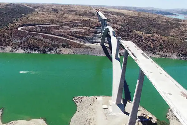
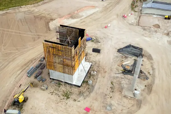
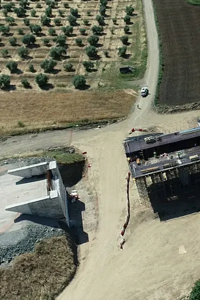
Construction progress monitoring with drones provides periodic aerial visibility of the project to supervise phase-by-phase progress, quality and safety. We generate orthophotos, point clouds and 3D models comparable over time, enabling accurate measurements, milestone documentation and early deviation detection with clear, traceable evidence ready for project reviews and committees.
We plan flights with controlled GSD and overlap to deliver reliable measurements of surfaces and distances. We provide georeferenced reports with temporal comparisons and KPIs, reducing site visits, improving coordination between contractors and accelerating decisions related to setting-out, replanning and certification of critical work units.

What Does Construction Progress Monitoring with Drones Involve?
Construction progress monitoring with drones delivers periodic aerial insight to control progress by phases, quality and safety. We generate orthophotos, point clouds and 3D models comparable between dates. Objective evidence reduces site visits, improves coordination and documents critical milestones with traceable imagery and metrics for project managers and technical directors.
Flights are planned with controlled GSD and overlap to obtain reliable measurements of surfaces, distances and slopes. We identify early deviations from the execution plan and provide a technical basis for setting-out, access planning and earthworks, accelerating decision-making and reducing field costs, idle time and unnecessary on-site risks.
We deliver georeferenced reports with temporal comparisons, KPIs and recommendations. Outputs integrate into CAD/GIS workflows and support meeting minutes and certifications. Date- and zone-based traceability accelerates committees, improves communication between contractors and facilitates milestone closure with clear, verifiable and audit-ready documentation.
Benefits of Construction Progress Monitoring with Drones
Construction progress monitoring with drones accelerates decisions and reduces costs through periodic aerial data, accurate orthomosaics and 3D models comparable by milestone. Fewer site visits and improved control of the schedule and quality.
Milestone and phase-based progress control.
Early detection of deviations.
Reliable measurements (areas and lengths).
Clear communication with project management and contractors.
Lower risk and reduced idle time.
Periodic reports ready for committee review.
We deliver georeferenced reports with orthophotos, 3D models and temporal comparisons; these prioritise corrections, add evidence to official records and improve end-to-end traceability of the project from start to completion.
Complementary Services
Types of Results and Deliverables
From each flight you obtain an updated orthophoto, 3D model, contours/DTM, date-based comparisons and reports ready for project management. All outputs are georeferenced and comparable between campaigns.


Why Choose SG solutions drones
We combine construction experience with Zoom + RTK + thermal technology. We deliver auditable reports in under 48 hours and a repeatable history by area and phase, optimising costs and increasing project visibility and control.
Frequently Asked Questions about Construction Progress Monitoring with Drones
Depending on project size and conditions, a full site can be captured within hours. A preliminary report is delivered in under 48 hours to support rapid decision-making.
High-resolution RGB imagery with controlled GSD, suitable for precise measurements, progress comparison and detailed visual analysis.
Yes. Operations are planned with risk assessment and coordination to ensure safety and minimal interference with on-site activities.
We operate under EASA/AESA regulations in the SPECIFIC category, with authorisations, SORA assessment and procedures for active worksites.
You receive a georeferenced report with orthophotos, 3D models, temporal comparisons, KPIs and files ready for CAD/GIS integration.
Fewer site visits, greater coverage and objective, comparable data. Improved coordination and faster decisions with reduced risk and cost.
Related Services You May Also Be Interested In
Enhance site control with 3D modelling, RTK precision and specialised drone operations in complex environments.